
Licensed California Land Surveyors

Topographic & Boundary Surveys

Rapid Certification & Permit Support

A Legacy of Precision Since 1941
Licensed California Land Surveyors
Topographic & Boundary Surveys
Rapid Certification & Permit Support
A Legacy of Precision Since 1941
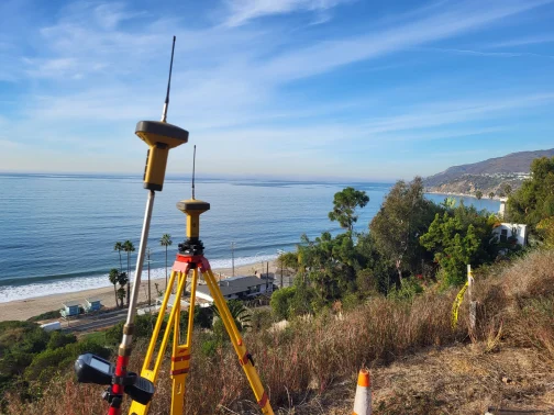
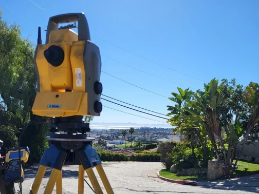
Full-Service Land Surveying in Southern California
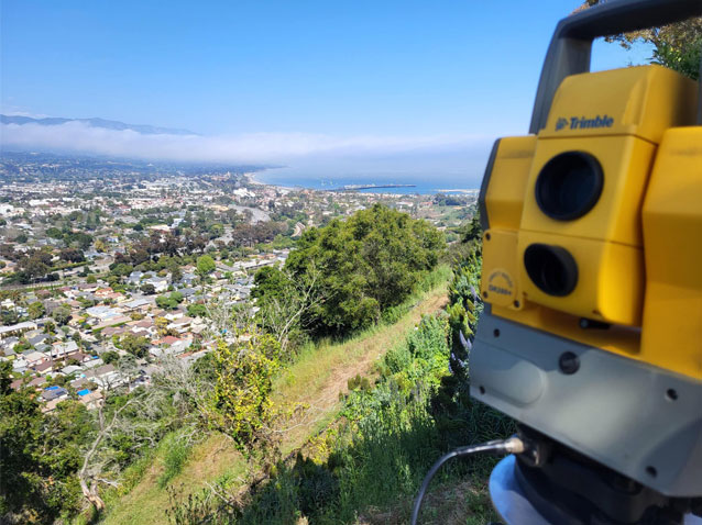
From the coastal estates of Santa Monica to the historic neighborhoods of Pasadena, Bonadiman Pacific Surveying, Inc. is your trusted partner for professional land surveying. With over 40 years of experience, we deliver precise, high-quality topographic and boundary data to help you navigate complex projects and meet rigorous municipal requirements. Contact us today for a rapid, competitive quote and discover how our expertise brings your project into focus with professional certification.
Bonadiman Pacific Surveying, Inc. provides comprehensive land surveying and story pole services across Southern California, ensuring accuracy, compliance, and project success.
A Legacy of Precision | Over 40 Years of Expertise
Founded by Charles J. Bonadiman, Bonadiman Pacific Surveying carries forward a family legacy of civil engineering and land surveying that has served Southern California for over 80 years.
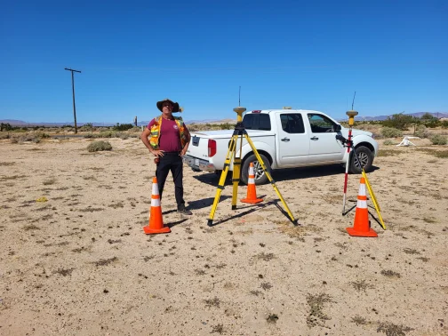
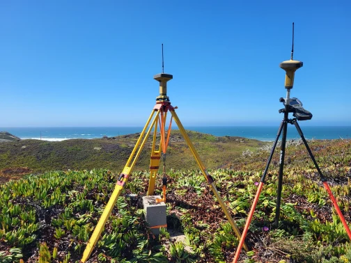
With a career spanning more than four decades, Charles provides a standard of technical accuracy that is unmatched in the industry. As a third-generation firm, we combine “boots-on-the-ground” experience with cutting-edge GPS and 3D Laser Scanning technology. Unlike general contractors or unlicensed firms, our work is led by a Licensed Professional Land Surveyor (PLS), ensuring that every boundary line, topographic map, and record of survey meets the legal standards required by architects, engineers, and city planning departments.
Our commitment to precision and client satisfaction drives our growth, and we’re excited to partner with you on your next project.
The Professional Advantage: Why Choose Bonadiman Pacific?
- Certified Professionalism: We are licensed by the California Board for Professional Engineers, Land Surveyors, and Geologists. Beware of non-licensed “surveyors”—only a PLS-certified firm can provide legally admissible data for your permits and title insurance.
- Speed & Affordability: We have optimized our workflow to provide the fastest turnaround in the Greater LA area without compromising the precision your project demands.
- Local Expertise: Our new Pasadena headquarters and Santa Monica office allow us to provide localized service with deep knowledge of Los Angeles County zoning and hillside ordinances.
- Proven Track Record: Since 1991, we have been the preferred choice for developers, architects, and homeowners who require “source of truth” data for their most ambitious projects.
Reviews & Testimonials
The Importance of Professional Licensure in Land Surveying
In the state of California, land surveying is a highly regulated profession for a reason: precision protects your investment. Hiring an unlicensed individual to determine property boundaries or elevations doesn’t just put your project at risk—it can lead to costly legal disputes, permit denials, and insurance liabilities.
At Bonadiman Pacific Surveying, Inc., we believe in a “measure twice, build once” philosophy. Every survey we perform is overseen by a Licensed Professional Land Surveyor (PLS). We provide the certified data and official documentation that architects, engineers, and city planning departments in Los Angeles and Pasadena require for project approval.
Why Speed & Certification Matter
We understand that in Southern California development, time is money. Our goal is to provide the fastest turnaround times in the region without ever compromising the integrity of our data. When you work with a licensed firm like Bonadiman Pacific, you get:
- Legally Admissible Data: Only a licensed surveyor can sign off on Records of Survey, Corner Records, and ALTA/NSPS Land Title Surveys.
- Permit-Ready Accuracy: Our topographic maps meet the strict requirements of the Los Angeles County and City of Pasadena planning divisions.
- Protection Against Errors: We stand behind our work with professional accountability, ensuring your foundations, setbacks, and boundaries are 100% accurate.
BEWARE OF NON-LICENSED “SURVEYORS”: Always verify that your surveyor holds a valid license from the California Board for Professional Engineers, Land Surveyors, and Geologists. Using unlicensed data can result in your project being halted and your investment being compromised.
Ready to Start Your Project?
Whether you need a Fire Recovery Package, a comprehensive ALTA Survey, or a precise Boundary Determination, Bonadiman Pacific is ready to deliver.
Contact our Pasadena or Santa Monica office today for a free, competitive quote. Call us at (310) 824-3219 or complete the form below.
Land Surveying Frequently Asked Questions
What types of land surveying services do you provide in Los Angeles?
We specialize in a full suite of professional services including Topographic Mapping, Boundary Surveys, ALTA/NSPS Land Title Surveys, and Corner Records. Our work is specifically tailored to meet the strict requirements of Los Angeles County and local municipal planning departments.
Why do I need a Licensed Professional Land Surveyor (PLS) for my project?
In California, only a Licensed Professional Land Surveyor can legally establish property lines or certify elevations for construction permits. Hiring a licensed PLS like Charles J. Bonadiman ensures your data is legally admissible, accurate, and compliant with the Professional Land Surveyors’ Act.
Do you offer a special package for Eaton and Palisades fire recovery?
Yes. We offer a specialized Fire Recovery Survey Package for homeowners rebuilding after the Eaton and Palisades fires. For $2,750, we provide a comprehensive Topographic and Boundary survey including a Corner Record to help fast-track your rebuilding process.
How long does a topographic or boundary survey typically take?
We prioritize speed and affordability. Most standard residential surveys in the Pasadena and Santa Monica areas can be completed within 5–10 business days, depending on the complexity of the terrain and the availability of historical records.
What is an ALTA/NSPS Land Title Survey, and when is it required?
An ALTA Survey is a comprehensive boundary survey that meets the national standards set by the American Land Title Association. These are typically required by lenders and title companies for commercial real estate transactions or high-end residential developments in the Greater Los Angeles area to ensure a clear, unencumbered title.
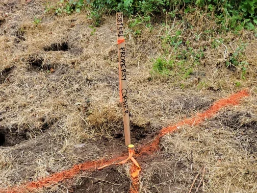
What is a Record of Survey or a Corner Record, and do I need one?
A Record of Survey or Corner Record is an official legal document filed with the County Recorder to permanently document property boundaries and monument locations. In California, these filings are often required by law when a surveyor establishes or re-establishes property corners. At Bonadiman Pacific, we handle the entire filing process to ensure your property rights are legally secured and documented for future reference.
How much does a professional land survey cost in Southern California?
Costs vary based on lot size, terrain, and the specific type of survey required. However, we are committed to affordability and will beat any good-faith written quote for topographic or boundary surveying services. Contact us today for a free, customized estimate.
Can a general contractor perform my land survey?
No. Under California law, general contractors are not licensed to perform land surveying. Only a PLS can certify property boundaries or topographic data. Using unlicensed data for your project can lead to permit denials, legal setbacks, and significant financial loss.